2026 Hurricane Season Forecast: El Niño Could Dampen Storms
The 2026 Atlantic hurricane season forecast predicts a potentially less active season, largely due to the influence of El Niño. Colorado State University's outlook estimates around 13 tropical storms, with six becoming hurricanes. Despite the forecast, experts urge continued preparedness, noting that even quieter seasons can bring significant threats.
Atlantic Hurricane Season Outlook Predicts Fewer Storms Amid El Niño Influence
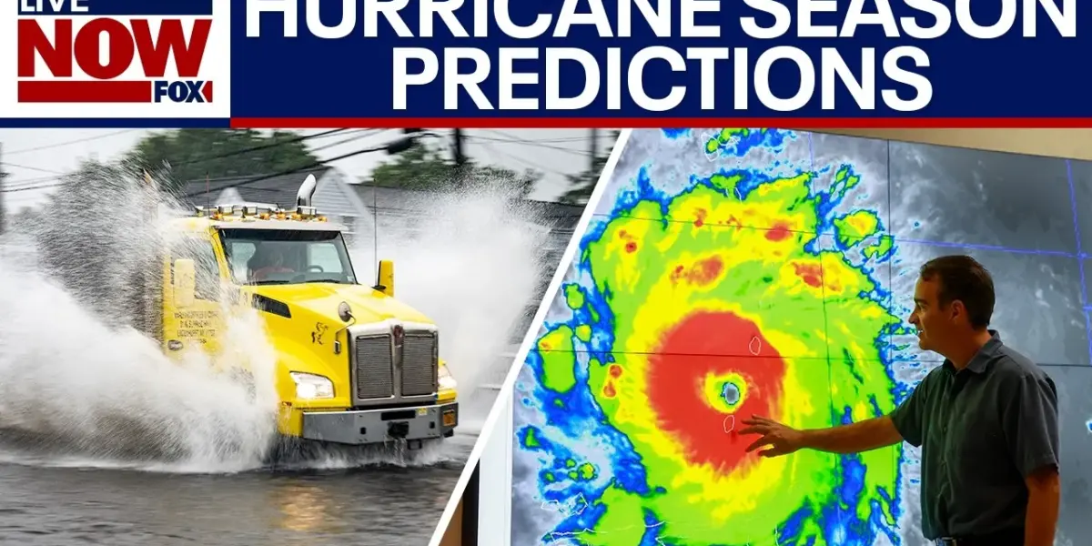
The highly anticipated 2026 Atlantic hurricane season forecast has been released, predicting a potentially less active season with a focus on the dominant role of El Niño. Colorado State University (CSU), a leader in hurricane forecasting, has issued its outlook, estimating a possibility of around 13 tropical storms, with six expected to strengthen into hurricanes. Of those, two could become major hurricanes, posing a significant threat to coastal communities.
El Niño’s Impact on Atlantic Activity
Meteorologists point to El Niño as the primary factor expected to suppress hurricane activity this year. El Niño, a weather pattern characterized by warmer-than-average sea surface temperatures in the equatorial Pacific Ocean, influences global weather. In the Atlantic, it typically leads to increased wind shear – changes in wind speed and direction with height – which can tear developing storms apart. Additionally, El Niño often strengthens trade winds, further stabilizing the atmosphere and hindering storm formation.
“What happens with El Nino, it suppresses hurricane activity because we have an increase of wind shear in the atmosphere in the tropical Atlantic Ocean… what that does is rip the storms apart.” – Meteorologist Joe Marti
Despite the expected El Niño influence, forecasters are also monitoring secondary factors that could increase storm activity. Warmer-than-average Atlantic Ocean temperatures earlier in the year and strong upper-level winds are contributing to a complex forecast. This creates a tug-of-war between factors that suppress storms and those that encourage them. While El Niño is the dominant force, the warmer ocean waters could lead to a closer-than-average season.
Past Storms Highlight Need for Preparedness
The forecast comes after recent years have seen devastating hurricane impacts. In 2024, Hurricane Helen caused widespread destruction in the Southeast, with Category 4 winds leading to flooding and landslides in North Carolina. The following year, Hurricane Aaron inundated coastal regions and impacted the Outer Banks. These events serve as stark reminders that even a less active season can bring life-altering destruction with just one storm.
“It only takes one, as everybody that’s been hit by a hurricane over the last several years knows that the one terrible day they had changes their lives for a long time.” – Transcript Excerpt
Forecasters emphasize that even with predictions of a slightly less active season, residents in hurricane-prone areas must remain prepared for the worst. Florida is identified as having the highest chance of a hurricane making landfall this year. With the official hurricane season beginning on June 1st, preparations are already underway along the East Coast.
Understanding El Niño and Its Potential Strength
El Niño is part of a larger climate pattern known as the El Niño-Southern Oscillation (ENSO). The strength of an El Niño can vary, with terms like “super El Niño” used to describe exceptionally strong events. While a strong El Niño typically suppresses Atlantic hurricane activity, its influence on other weather patterns, such as winter snowfall in the Northeast, is also being considered.
The warming of the tropical Atlantic Ocean, with expected water temperatures between 84 to 89 degrees Fahrenheit during the peak season (August, September, October), provides ample energy for storm development if other conditions align. This warmer water is crucial, as temperatures above 79 degrees Fahrenheit are needed for storms to strengthen.
Beyond Landfalls: Indirect Impacts to Watch
While direct hurricane landfalls receive significant attention, forecasters and residents are also wary of indirect weather-related impacts. Rip currents along the Jersey Shore and other East Coast beaches can become dangerous even when a hurricane is hundreds of miles offshore. Coastal flooding is another significant concern; in August 2025, parts of the New Jersey Shore experienced their highest summertime high tide on record due to Hurricane Aaron, despite the storm being far offshore and not bringing rain or direct wind impacts.
These indirect effects highlight the broad reach of tropical systems and the need for vigilance throughout the hurricane season. Meteorologists stress that preparation should always be a priority, regardless of the seasonal outlook.
Looking Ahead: Vigilance and Preparation
As the 2026 hurricane season approaches, the combination of El Niño’s suppressive effects and warmer Atlantic waters presents a complex forecast. While the outlook suggests a potentially less active season, the possibility of powerful storms remains. Residents in coastal areas are urged to stay informed and continue with their hurricane preparedness plans. The official start of the season on June 1st marks a critical time for readiness and awareness.
Source: Highly anticipated 2026 Atlantic hurricane season outlook released (YouTube)
Related Articles


NASA Prepares for Moon Mission Launch Amidst Weather Watch
NASA is nearing a critical launch window for its upcoming moon mission, with teams working through final preparations and safety checks. Meteorologists are closely monitoring weather conditions, which currently show an 80% chance of a 'go' for liftoff, though isolated showers remain a possibility. The mission marks a significant step in humanity's return to lunar exploration.


Congress Returns: Iran War Powers, DHS Funding, Bondi Probe, Swallwell Scandal
Congress returns to a packed schedule with debates on war powers for the Iran conflict, stalled DHS funding, and former AG Pam Bondi's refusal to testify. Meanwhile, Representative Eric Swalwell faces potential expulsion amid serious allegations, and a crucial FISA reauthorization vote is on the horizon.


Epstein Survivor Questions First Lady’s Call for Public Testimony
Epstein survivor Marina Lacerda questions First Lady Melania Trump's call for public testimony, calling it a "deflection of responsibility." Lacerda argues that survivors have already shared their stories and that the truth lies within the existing files. She demands investigations into the prominent names linked to Epstein, not further trauma for victims.